Sites: Courthouse Rock, Double Arch
Mileage: Around 9.5 with Side Trail to Campsite
Camp Sites: Koomer Ridge Campground, Side Trail off of Tunnel Ridge Road
A few weeks back, I got my first taste of backpacking in 2013 with a trip to a new Red River Gorge location. Here's a quick recap of the entire trip with some tips that we found along the way.
Night 1: Koomer Ridge Campground
We left Northern Kentucky around 3:30 PM, and made it to the campground before 6:00. For $7 (winter rate) we got a perfectly flat campsite that fit all 3 of our tents easily. The tent area was crushed gravel, and had several lantern posts and a picnic table. This site left nothing to be desired, as the area is well maintained and patrolled.
 |
| Koomer Ridge Campground |
 |
| Backcountry Palaces |
That night dipped into the low 30's. Not cold enough to freeze my water bottles but cold enough that I could see my breath in the morning. I was in a 20 degree TNF sleeping bag on a Therm-a-Rest 40th Anniversary Sleeping pad and was warm enough to get a few hours sleep.
Day 2 - Courthouse Rock and Double Arch:
The next morning we woke up and cooked a campsite breakfast of eggs, bacon, and home fries. Freshly fortified and eager to go, we headed off to the Auxier Ridge parking area where we set off for Courthouse Rock.
Courthouse Rock:
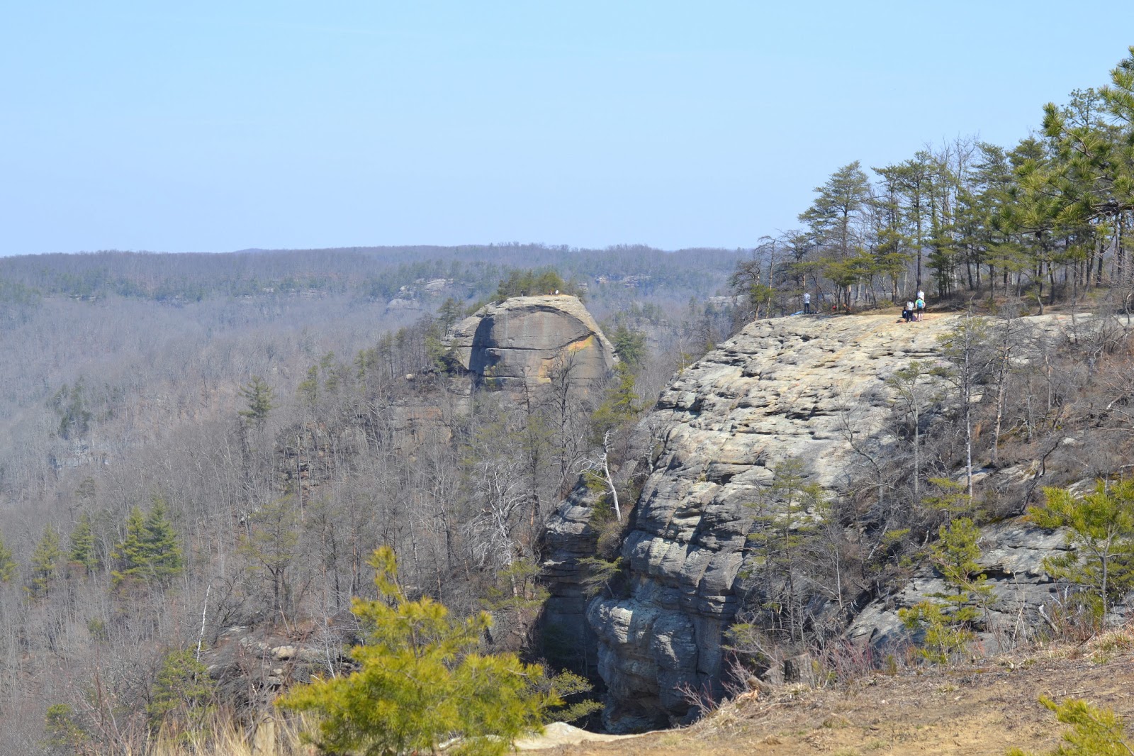 |
| Courthouse Rock from a Distance |
Auxier Branch:
You can follow the loop back around, and hike back to the Auxier Ridge Parking area, or you can take Auxier Branch over to the Double Arch area. We took Auxier Branch which is under a Mile, and hiked up to Double Arch. Double Arch earned it's name by having a small hole in the middle of the natural bridge that was formed here. Making it to Double Arch is a Moderate hike, as there is some more serious elevation change to deal with.
Double Arch:
There is a staircase going up to the lower area of Double Arch,
 |
| Joey, the Spider Dog |
Once on Tunnel Ridge road, I looked at my maps of the area. (The best maps in the area are made by OutrageGIS) and found some campsites marked on unofficial side trails to the east of Tunnel Ridge Road. The first side trail was a bust, as every camp site was jam packed with campers. To the south about another 1/4 mile there was another trail. About a mile and a half in, we found a large site that was perfect to fit our tents and gear. we settled in to cook dinner, and the only complaint was a dead tree that was creaking loudly in the wind all night.
Day 3 - Out and Back to Indian Staircase:
After a quick morning hike back to the Parking area, we grabbed breakfast in Slade and headed over to a side trail to Indian Staircase. This is a quick hike on an established trail of maybe 1/2 mile, and then an very difficult hike up to the staircase area. I intend to do a more thorough article on this area later this summer, so stay tuned and I will give this area it's due in it's own post.
All told, it was an excellent trip, and one that is worth doing. If you have any questions, please leave them in the comments section and I will address them as soon as I can.
No comments:
Post a Comment